


One of the most popular but challenging hikes in the entire northeast, The Pemi Loop covers several of New Hampshire’s most dramatic ridgelines and features some of the most iconic views in the entire White Mountain National Forest. The route traverses or approaches a dozen 4,000-foot peaks, making it a great way for peakbaggers to bang out their lists, but it also features grueling terrain that isn’t to be taken lightly.
Those who attempt the Pemi Loop should be prepared for a long and difficult trip, but as long as the proper preparations are made it should also be a highly rewarding and memorable hike. So if you’re thinking about hiking a Pemi Loop, here is a guide covering everything you’ll need to know.
WHAT IS THE PEMI LOOP?
The Pemi Loop is a loop hike covering approximately 32 miles, with the option of adding a few more miles if you decide to hit the extra 4,000-footers not directly on the route. The loop features between 10,000 and 12,000 feet of elevation gain and typically takes between one to three days depending on a hiker’s pace.
The loop can be hiked in either direction but is most commonly hiked clockwise, that way hikers will get the biggest climbs out of the way early. For our purposes, we’ll cover a clockwise route that includes all of the 4,000-footers along the trail along with the extra ones commonly included in an “extended” loop.
As a bonus, we’ll also look at two additional peaks that are far less accessible but could be added for a hardcore “super-extended” loop.
So what peaks will you encounter along the route? Here’s a quick summary:
Basic Loop
- Mt. Flume: 4,328 feet
- Mt. Liberty: 4,459 feet
- Mt. Lincoln: 5,089 feet
- Mt. Lafayette: 5,260 feet
- Mt. Garfield: 4,500 feet
- South Twin: 4,902 feet
- Mt. Bond: 4,698 feet
- Bondcliff: 4,265 feet
Extended Loop
- Galehead: 4,024 feet
- North Twin: 4,761 feet
- Zealand: 4,260 feet
- West Bond: 4,540 feet
Super Extended Loop
- Owl’s Head: 4,025 feet
- Mt. Hale: 4,054 feet
Most of the extended loop peaks are easily accessible via a short spur path and can be grabbed without much difficulty, and West Bond is included so frequently that it’s generally considered part of the standard route even if it’s not directly on the loop.
Regardless of which peaks you include or which direction you hike, your journey will almost always begin at the Lincoln Woods trailhead off the Kancamagus Highway. From here you will start up the Lincoln Woods trail and either branch off towards Mt. Flume on the Osseo Trail or towards Bondcliff further down at the Bondcliff Trail junction. Here’s a rundown of the extended clockwise route.
The Trails
Lincoln Woods to Osseo Trail: The first section of trail is basically flat and is a good opportunity to warm up. The 1.4-mile stretch goes by quickly and only gains about 150 feet of elevation. Once you see the sign for the Osseo Trail, turn left. Now the real fun begins.
Osseo Trail to Franconia Ridge Trail: The biggest climb of the entire trip, the Osseo Trail gains about 2,950 feet of elevation over 3.8 miles from the Lincoln Woods Trail to the Franconia Ridge Trail. The trail ascends moderately throughout, gaining steadily the first two miles before climbing more steeply further up. The final stretch includes the first good views of the hike along with some ladders, but once past those the first major summit will be within reach.

Franconia Ridge Trail to Little Haystack: Once meeting up with the Franconia Ridge Trail, the summit of Mt. Flume is less than 0.1 miles away. The view from Flume is outstanding, with virtually the entire Pemi Loop route visible encircling nearby Owl’s Head. From here it’s another mile to the summit of Mt. Liberty, including a steep drop and then a steep climb between the two peaks, followed by another 1.9 miles from Liberty’s summit to Little Haystack, which features a more gradual descent and climb. Overall this section covers 3.0 miles and includes about 1,300 feet of elevation gain.

Little Haystack to Mt. Lafayette: Anyone who has ever hiked the Franconia Ridge Loop is no doubt familiar with this iconic stretch of trail. Covering 1.7 miles, this section of the Franconia Ridge Trail is completely exposed and offers jaw dropping views in every direction. While not a place you want to be in inclement weather, the ridgeline is one of the highlights of the Pemi Loop and is relatively moderate in terms of elevation gain compared to some of the stretches you’ve seen before.
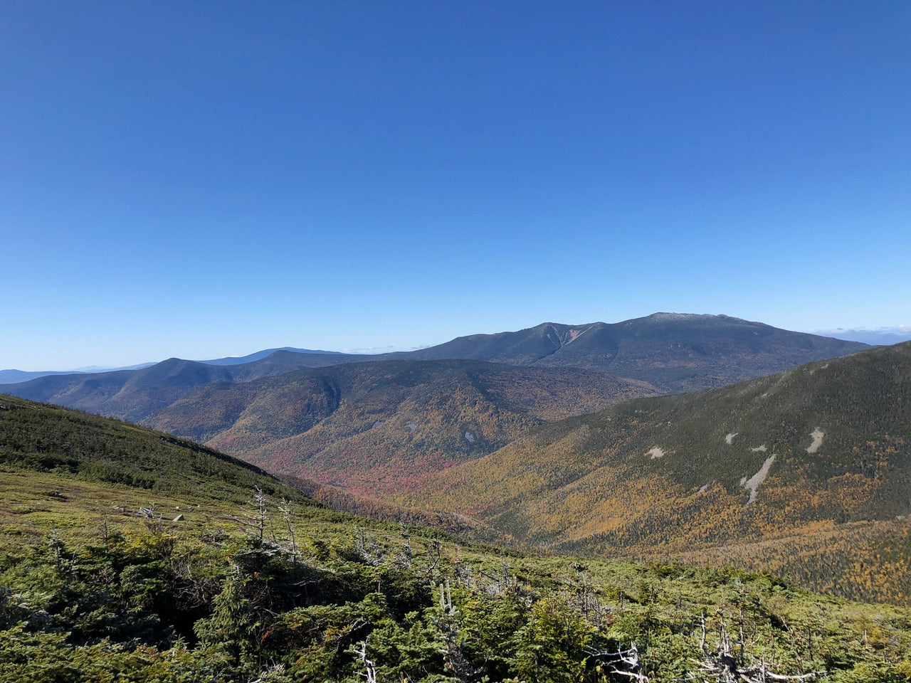
Mt. Lafayette to Mt. Garfield: From the summit of Mt. Lafayette you can clearly see Mt. Garfield jutting out of the landscape in the distance, and in order to get there you’ll have to go down. Way down. Between Lafayette and Garfield you will drop close to 1,500 feet down the Garfield Ridge Trail, which primarily navigates smooth slabs of rock that can be treacherous in rainy conditions. After descending for what feels like an eternity, you will eventually reach a quick up and down, followed shortly after by Garfield Pond. From this area it’s about an 800-foot climb to Mt. Garfield, which offers a fantastic view south towards the area you’ve already covered so far. Overall it’s about 3.2 miles from Lafayette to Garfield.
Mt. Garfield to Galehead Hut: Depending on whether you are aiming for a two-day or a three-day loop, there are a couple of good camping options in this area. Just below the summit of Mt. Garfield is the Garfield Ridge Campsite, and if you’re willing to push a little further, it’s another 2.7 miles down the Garfield Ridge Trail to the Galehead Hut. This section is challenging but doesn’t feature huge swings in elevation, and once at the hut you can also do a quick 0.8-mile out and back to nearby Galehead Mountain.
Galehead Hut to South Twin: Brace yourself, this part is going to be rough. Picking up the Twinway after the Galehead Hut, the trail climbs more than 1,100 feet in only 0.8 miles to the summit of South Twin. This section is an unrelenting mass of steep rocks, so your best bet is to take it slow. Eventually you will top out on South Twin, which features one of the best and most underrated views in all the White Mountains. From here you can also do a quick out and back to North Twin as well, which is an additional 2.2 miles round trip.
South Twin to Mt. Guyot: Once you’re finished with the Twins, continue down the Twinway for another 1.8 miles to the Bondcliff Trail junction. From here Mt. Guyot’s bald summit is a short walk away, and if you’re inclined to make the 2.6-mile round trip out and back to nearby Mt. Zealand, you can continue further down the Twinway and bag that as well.
Mt. Guyot to The Bonds: Once you’re ready to proceed past the Zealand detour, take the Bondcliff Trail and make your way up and over the summit of Mt. Guyot. From this point on you will be entering the remote home of The Bonds, which feature some of the most highly sought after views in the White Mountains. If you are doing a three-day loop, the Guyot Campsite is an ideal stopping point, and as you make your way through be sure to hit the short out-and-back (1.0 miles round trip) to West Bond.

Then proceed up to the summit of Mt. Bond, where the bare ridgeline leading to Bondcliff can be seen looming in the distance. Continue onward to Bondcliff, where arguably the best view in the region awaits. Overall the segment from the Twinway-Bondcliff Trail junction to Bondcliff’s summit is 3.4 miles (including West Bond) and features about 950 feet of elevation gain and about 1,200 feet of elevation loss.
Bondcliff to Lincoln Woods Trail and Beyond: Now that you’ve taken your Bondcliff photo and soaked in some of the best sights New Hampshire has to offer, it’s time to begin the long, arduous trip back to the car. The final stretch of the Pemi Loop is somewhat anticlimactic, as once you get past the Bondcliff summit the trail dips back below the trees for the remainder of the hike.
From Bondcliff the trail drops more than 2,800 feet over 6.0 miles to the Franconia Brook Bridge, at which point the trail meets back up with the Lincoln Woods Trail. After that it’s just about 2.9 miles of flat, easy trail to the parking lot and the end of your Pemi Loop adventure.
BONUS – Mt. Hale
If you are really committed to grabbing every 4,000-footer you possibly can on your hike, including the viewless Mt. Hale, you can proceed another 2.9 miles down the Twinway past Zeacliff to the Lend-A-Hand Trail, which you’ll reach just before hitting the Zealand Falls Hut. From there it’s another 2.7 miles to Hale, and all told the out and back from the Bondcliff Trail junction to Zealand and Hale will add 12 extra miles and an additional 4,000 feet of elevation gain. Not many people include Hale in their Pemi Loop, but it is an option.
BONUS – Owl’s Head
Throughout your Pemi Loop journey one of the ever-present features in the landscape will be Owl’s Head, which pokes out of the middle of the Pemigewasset Wilderness and ranks among the most inaccessible 4,000-footers in New Hampshire. For those who want to include Owl’s Head as part of their trip, there are two ways to reach it.
One is by bushwhacking the Lincoln Slide, which leads down from just below the summit of Mt. Lafayette to the valley below not far from the Owl’s Head path. From there you can summit Owl’s Head and make your way north up the Lincoln Brook Trail to the Thirteen Falls Campsite, and from there back up to the ridgeline via the Franconia Brook Trail, where Mt. Garfield will only be a short climb away.
If you’re not comfortable with such an epic bushwhack, the other option is to continue from Lafayette to Mt. Garfield and then do an out and back to Owl’s Head using the Franconia Brook and Lincoln Brook Trails. Either one of these routes will add between 10-14 miles to your hike, but for those who are inclined to hit every 4,000-footer possible on their trip, this is one way to help do that.
LOGISTICS, LODGING AND RESOURCES
Once you’ve committed to the Pemi Loop and know which direction you’ll be hiking, the next step is working out all the logistics to make sure your hike is successful. Are you looking to do the full loop in one day, or spread it out of two or three? If you plan on spending the night, which shelters should you aim for? Where can you fill up water? If things go sideways, where are the best bailout points?
These are questions you’ll want answers for before you start your hike, so here’s an overview of the resources and red tape you’ll want to be aware of. For our purposes, we will focus on the logistics surrounding a Pemi Loop in three-seasons conditions.
Parking: By and large anyone who attempts a Pemi Loop will be starting and finishing at the Lincoln Woods Trailhead off the Kancamagus Highway. There is a small fee to park here, so make sure you check the price ahead of time and be sure to bring enough cash to cover the number of nights you plan on being out.
Camping and Lodging: There are a number of convenient camping options along the route, giving hikers plenty of choice whether they’re looking to complete the hike in one, two, three or even four-plus days.
Going clockwise, the Liberty Springs Tentsite is 6.9 miles into the trip and only about 0.3 miles off trail just past the summit of Mt. Liberty, making it a good stopping point for those who get a late start in the day or plan on taking their time.
For those looking to complete a three-day loop, the best stopping point on day one is probably the Garfield Ridge Campsite, which sits at around 13.3 miles into the route and is only 0.1 miles off trail. Those who would prefer not to camp can push 2.4 miles further to the Galehead Hut (15.7 miles in), which is probably the best stopping point for someone trying to complete a two-day loop from a mileage standpoint. The AMC huts are significantly more expensive than the campsites, however, but do offer more amenities and the opportunity to enjoy a hot meal.
The last practical camping option for the final stretch of the loop is the Guyot Shelter, which comes 19 miles into the route and is 3.3 miles past the Galehead Hut. This is a great place to spend the second night of a three-day loop and set yourself up for a big finish on The Bonds.
Outside of these spots, hikers may be able to find their own campsites along the route, but all hikers who opt to go this route should make sure to read up on the latest rules and regulations governing backcountry camping in the White Mountains National Forest. Notably, camping is not allowed within alpine zones, ruling out the stretches above treeline along Franconia Ridge and leading to Bondcliff.
One last thing, while it’s not a recommended stopping point, anyone who finds themselves in a pinch along Franconia Ridge has the option to hit the Greenleaf Hut on the shoulder of Mt. Lafayette if they choose. The thing to remember is that the Greenleaf Hut is 1.0 miles off trail and 1,000 feet down, meaning anyone who stays there and wants to continue their loop will have to make a long, steep climb back up to the summit of Lafayette the next morning, which definitely isn’t ideal.
Water and Resupply: While water is plentiful throughout the Pemigewasset Wilderness, there are several dry stretches over the course of the loop that hikers should be mindful of. Notably, there aren’t any reliable water sources directly along the Franconia Ridge segment, and unless you’re willing to take a half-mile detour to the Liberty Springs Tentsite, you may not be able to fill up until you reach either Garfield Pond or the Garfield Ridge Tentsite.
Be sure to carry enough water for this section and be mindful of how much you have left as you make your way through. Anyone attempting a Pemi Loop should also carry a portable water filter to safely take advantage of the springs and streams available at the backcountry campsites.
If you find yourself running low on supplies midway through the hike, the Galehead Hut offers the best opportunity to restock on anything you need. The hut has food, snacks and other gear available for purchase, plus free drinking water for anyone who needs to top off.
THINGS TO KEEP IN MIND
Once you’ve made your plan and are ready to start your loop, there are a few more things you’ll want to get squared away before hitting the trail.
Check the Weather! The Pemi Loop traverses several stretches of exposed alpine trail, and if bad weather strikes when you are above treeline you may find yourself in a potentially life-threatening situation. Always be sure to check the latest weather forecasts before and during your hike, and if bad weather is forecasted at a time you expect to be along Franconia Ridge or near The Bonds, you might want to change your plans accordingly.
Plan Bailout Points: Should you have to end your hike early due to bad weather, an injury or some other unforeseen issue, there are no shortage of bailout points you can take advantage of. Along the Franconia Ridge section, the Liberty Springs Trail, Falling Waters Trail, Greenleaf Trail and Skookumchuck Trail will all take you down towards I-93, where finding a ride shouldn’t be too difficult.
Along the northern section you can bail down the Garfield Trail, Gale River Trail or North Twin Trail, which are considerably longer routes but will lead to popular hiker parking lots and eventually Route 3. The Bonds is a bit trickier, but if it’s not possible to push ahead towards the Lincoln Woods Trailhead, you can also take the Twinway down to the Zealand Falls Hut, where the hut crew should hopefully be able to provide additional assistance if necessary.
Pack the Essentials: As with any hike, it’s important to pack all of the essential gear needed for the trip. In addition to food and water, make sure you pack extra layers to account for the colder and windier conditions you might encounter above treeline, and make sure that you never wear cotton. Also make sure you bring a headlamp in case you find yourself out after dark, a map and compass to help with navigation, a portable water filter, and if you use your phone for photos, navigation or anything else, bring an external battery charger to keep the phone from dying.
Have fun! The Pemi Loop is a massive undertaking that will push you to your limits physically and emotionally, but it’s also one of the grandest, most rewarding hikes the White Mountains have to offer. If you take all of the necessary precautions, plan appropriately and pick a good weather window, you’ll be rewarded with one of the best hikes of your life!
~Mac Cerullo for Burgeon Outdoor
Check our other great hiking posts:

Burgeon Outdoor was founded in 2019. Burgeon’s mission is to help mountain communities flourish. Burgeon proudly manufactures premium outdoor apparel in Lincoln, NH. By manufacturing locally, Burgeon creates year round jobs in the White Mountains. 5% of Burgeon’s sales support its community and environmental efforts. To learn more, please visit our studio at the Village Shops in Lincoln, our website burgeonoutdoor.com or call us at 603-745-7123.
